History that now exists
Researchers explore the impact of redevelopment on Conn’s host city
A huge hole in New London’s history has now been filled thanks to the comprehensive and meticulous research of a team of Connecticut College students, faculty and staff.
On Sept. 22, Assistant Professor of Art History and Architectural Studies Anna Vallye and her team of colleagues and students launched “Mapping Urban Renewal in New London: 1941-1975,” an interactive website that delves into the impact the federal programs designed to revitalize metropolitan areas had on the Whaling City.
“This history had really never been told in depth. It was exciting to be the first to really research how the face of the city was so dramatically transformed,” Vallye said during a live launch event that featured a history of the project, a brief history of urban renewal in New London, video reflections from student researchers, and a website demonstration.
The interactive and immersive site provides users with an in-depth look at how federal programs altered the physical, social and cultural landscape of the city. Each section of the site tells a different side of the urban renewal story, from destruction and construction, to bridges and roads to redevelopment and community, with a particular focus on the Hodges Square and the Winthrop Cove area. Another section features reflection videos made by the 43 student researchers.
Part of Humanities Research for the Public Good, an initiative sponsored by the Council of Independent Colleges and The Andrew W. Mellon Foundation, the project was a collaborative effort. Linda Lear Special Collections Librarian Rose Oliveira and Associate Director of Engaged Scholarship and Community Learning Kim Sanchez worked with Vallye and alongside the students—including four student researchers and students in two courses taught by Vallye. New London Landmarks also partnered on the year-long research project. In addition, the team collaborated with Beverly Chomiak, a senior lecturer in geology, to create Geographic Information System maps of the geographical changes to the city, and with Professor of Art Andrea Wollensak on data visualization.
To piece together this largely forgotten history of New London and reconstruct the complicated timeline of events, the researchers spent the year poring over institutional records, newspapers, maps, plans, private papers, historical photographs and other primary source materials. Each student pursued their own line of research, and the results were woven together into the final project.
Davis Badger ’21 studied the residents who were displaced by urban renewal by examining census data and old New London directories to follow the movements of those who lived on the streets slated for demolition.
“I started to notice some patterns emerging in my research, specifically that minority populations were displaced at a much higher rate during urban renewal,” he said. While people of color made up just 7.8 percent of the population of New London at the time, for example, the research revealed that they represented 24 percent of those displaced during the Winthrop urban renewal project.
Kezia Rogers ’20 focused her research on construction, specifically which buildings were constructed during the 1960 and ’70s.
“One of my favorite parts of this class was learning to use archival research to piece together a story. It’s been rewarding to find out exactly what happened in the story of urban renewal,” she said.
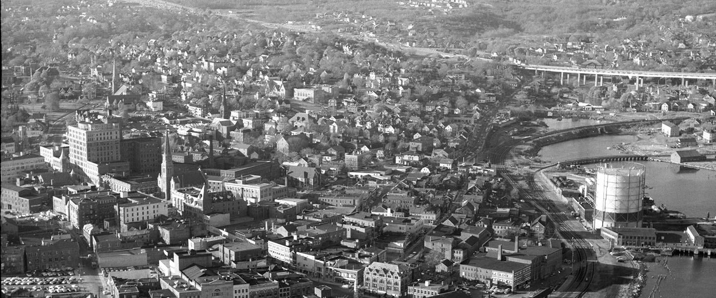
Vallye began the live launch event with side-by-side aerial images of the city from 1934 and 1995, which show the dramatic change in the physical landscape after the construction of the I-95 highway, the Gold Star Memorial Bridge and the various on- and off-ramps.
“You can’t go from one end of New London to another—all of 5.6 square miles—without at some point getting on the highway. It’s pretty present in the environment of the city,” she said.
Vallye also showed numerous historical photographs of the neighborhoods that were torn down to facilitate the highway construction.
“As any historian knows, there are always 10, 20, 25 different sides to every story. By some measures, such as the redevelopment agency’s appraisals for example, the neighborhood was very poor and run down and terrible. By some other measures … it was a beautiful place,” she said, sharing that residents recalled a tight knit, friendly and diverse neighborhood.
On one of the interactive maps on the website, users can track the movements of 68 of the residents who lived in the impacted area in 1964. By 1975, only 15 of the households were still in the New London directory, with the rest of the residents moving mostly to surrounding suburban towns.
The research team also explored the timeline of public opinion of urban renewal, which showed that while the effort is largely viewed negatively in hindsight, most of the city’s residents actually supported the initiative at the outset. They also looked at the economic impact, as Vallye pointed out, “the whole point of [urban renewal] was to elevate cities economically, to elevate their tax base.”
“What we found tracing the statistics of New London from the 1960s to the 1980s … was that you don’t really see that much of a [positive economic] impact,” she said.

